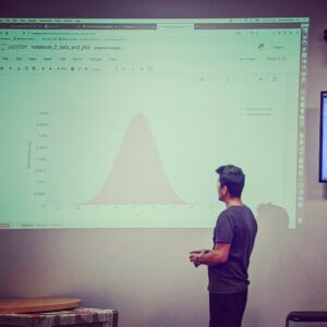
 CIC data-scientist Dr Michael Pracy was invited to give one of the five workshops at the recent X-sensing conference held in Coffs Harbor. His workshop, titled: Dynamic Dashboards and Visualization Using Python, was cantered around the open-source infrastructure he developed at CIC for building and deploying demonstrator data-visualization dashboards for internal analytics projects at UTS. The conference was multi-disciplinary and aimed at data-focused scientists and educators. It was attended by academics and professional from a wide set of fields, including astronomy, biology, linguistics, ecology, archaeology, geology, geography, medical imaging, sensors and many others. The full week conference consisted of 5 training workshops, which were dedicated to teaching data-science and machine learning techniques, followed by a hackathon to solve a selected set of the real-world problems which participants had brought with them.
The workshops focused in on machine learning, High powered computing for deep learning and dynamic data-visualization. While the hackathon projects were more varied and included “Retrofitting a drone with expensive but under used equipment found lying around University labs” and “using Deep Learning to identify regions in images of coral bleaching in the great-barrier reef that had been affected by glare”.
The conference workshops were intended to be an ongoing resource and the CIC workshop on data-visualization is stored in the workshop repository. It includes a full set of the workshop materials, code and instructions on the procedure from installing software, writing the code and deploying it to the web. It is available for anyone to use and will remain in place there for the foreseeable future and be updated as needed. The future of the Drone retrofitted with a scientific grade LIDAR detector by using parts made using a commercial grade 3D printer is a little less assured.